Quick answer
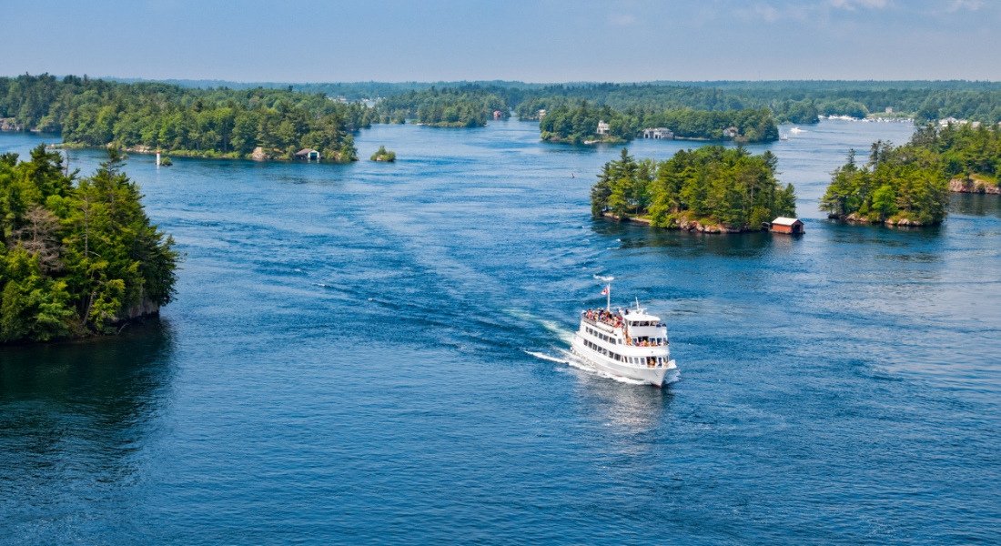
The ivy lea cruise map traces a clockwise loop departing from 95 Ivy Lea Road in Lansdowne, navigating the Canadian Middle Channel past Georgina, Constance, and Stovin islands before crossing toward the American span near Boldt Castle, then returning along the international boundary. The one-hour route covers approximately twelve nautical miles through the eastern Thousand Islands archipelago, with narrated commentary marking each named island, lighthouse, and historic estate visible from the vessel.
The Thousand Islands archipelago contains exactly 1,864 charted islands scattered across fifty miles of the St. Lawrence Seaway, but only a fraction of that geography is visible from the water during a standard cruise departure. The ivy lea cruise map focuses on the eastern cluster—a dense concentration of private estates, historic landmarks, and wooded islets that sit between the Canadian mainland and the deeper American channel. Understanding this geography before departure transforms the tour from a scenic ride into a structured exploration of named places, each with its own maritime history and architectural signature. The dock at Ivy Lea Road sits at the midpoint of the Thousand Islands International Bridge, a steel span that connects Ontario and New York across five separate islands. Vessels depart from the Canadian side and immediately enter the Middle Channel, a navigable corridor flanked by Georgina Island to the north and a succession of smaller granite outcrops to the south. Within the first ten minutes, passengers pass Zavikon Island—often cited as the shortest international bridge in the world, though its boundary status remains contested—and the stone tower of Sunken Rock Light, an active navigation beacon marking the submerged shoal that claimed multiple steamships in the nineteenth century. The route map shows these points in sequence, allowing visitors to track their position against the printed itinerary. Midway through the loop, the vessel crosses the international boundary and approaches the American channel, where Boldt Castle dominates the skyline from Heart Island. The map does not indicate a docking stop here; passengers view the Rhineland-style towers and Italian gardens from the water while the captain maintains the scheduled circuit. The return leg follows the boundary line back toward the bridge, passing the gabled rooftops of private summer estates and the wooded reserves of the St. Lawrence Islands National Park. Narration aboard the vessel corresponds to the printed ivy lea cruise map, calling out each named island as it appears to starboard or port, so visitors can follow the route in real time and identify the landmarks they photograph. The cruise operates daily from 09:00 to 17:00, with departures scheduled hourly during peak season. Passengers who arrive with a route map in hand—either printed from the operator's website or reviewed in advance—report a more coherent experience, as the verbal narration often references island names and cardinal directions that are difficult to track without spatial context. The map itself is not distributed automatically at boarding; it is available online and at the ticket counter, making advance review the most reliable preparation for first-time visitors.
“The cruise traces the international boundary, passing named islands and historic estates in a sequence that corresponds to the printed route map, allowing passengers to track their position throughout the one-hour loop.”
Navigating to Your Ivy Lea Cruise Map Location
The Ivy Lea departure point is located at 95 Ivy Lea Road, Lansdowne, ON K0E 1L0, Canada. It is most easily accessed by car via the Thousand Islands Parkway.
Highway 401 to Exit 675 (Thousand Islands Parkway)
Local service from Lansdowne or Gananoque
Ivy Lea Cruise Map Operating Hours
The Ivy Lea cruise facilities are open daily to accommodate visitors exploring the Thousand Islands region. These hours ensure consistent access for those planning their transit through the area.
| Monday | 09:00–17:00 | |
|---|---|---|
| Tuesday | 09:00–17:00 | |
| Wednesday | 09:00–17:00 | |
| Thursday | 09:00–17:00 | |
| Friday | 09:00–17:00 | |
| Saturday | 09:00–17:00 | |
| Sunday | 09:00–17:00 |
Best Time to Follow Your Ivy Lea Cruise Map
To navigate your Ivy Lea cruise map effectively, prioritize an arrival within the 09:00–16:00 window. This strategy helps visitors avoid peak midday crowds and ensures sufficient time for cruise departures.
Early Season (May–June)
Moderate crowdsMild, 15°C to 22°C
The region experiences fewer tourists and comfortable sailing conditions before summer peak.
Peak Season (July–August)
High volumeWarm, 23°C to 27°C
Expect busier terminals and increased vessel traffic during these months.
Late Season (September–October)
Lower volumeCool, 10°C to 18°C
Autumn offers quieter waterways and cooler temperatures as the season draws to a close.
Weekday Mornings
Low to moderate—
Arriving near the 09:00 opening time provides the most consistent access to cruise schedules.
Verdict: For the best experience, plan your visit for Tuesday to Thursday mornings during September or October.
Planning Your Ivy Lea Cruise Map Itinerary
This plan suits first-time visitors arriving mid-morning for the 1-hour cruise. Allow 90 minutes total, including check-in and departure prep.
Arrive and Check In
Park at the Ivy Lea Road departure point and head to the ticket office or kiosk to confirm your reservation. Aim to arrive 15–20 minutes before your scheduled departure to avoid last-minute rushes.
Board the Vessel
Follow crew directions to your seating area—upper deck offers open-air views, while the lower cabin provides shelter. Stow any bags and settle in before the narration begins.
Depart into the Islands
The cruise pulls away from the dock and enters the Thousand Islands channel. Listen for the captain's commentary on island ownership, historic estates, and the international border.
Pass Boldt Castle Vista
The route offers a distant view of Boldt Castle on Heart Island, a key landmark in the archipelago. Cameras and binoculars are useful here for detail.
Return to Dock
The vessel completes the loop and ties up back at Ivy Lea. Disembark at your own pace and explore the small shoreline area before heading onward.
Nearby Sights Beyond the Ivy Lea Cruise Map
Visitors often pair their cruise with regional landmarks to round out a day in the Thousand Islands. These sites are located within a short drive of the Ivy Lea departure point.
1000 Islands Tower
This observation tower provides a panoramic perspective of the river and islands viewed during your cruise. It complements the water-level experience with an aerial view of the region.
Rockport Cruises
Located nearby, this area offers additional maritime history and village charm along the St. Lawrence River. It serves as a secondary hub for exploring the river ecosystem.
Boldt Castle
This historic site on Heart Island is a prominent feature often referenced during river tours. Visiting the grounds provides context to the architecture and history discussed on the cruise.
Check availability
Frequently asked questions about ivy lea cruise map
Everything you need to know about ivy lea cruise map